1.7.70 — GROTA: the aerial photo works again, on older Androids too
Release 1.7.70 · 22 September 2026 · Full release notes
- The aerial photo on a shelter's card shows again. In 1.7.68 it did not appear for anyone, because GUGiK's orthophoto service changed how it works. GROTA now retries and, if needed, uses the service's backup version.
- On Android older than 14 the photo never loaded: the phone did not trust the Geoportal server's certificate. The app now knows that certificate — for that one server only.
- Messages about a missing location permission say where to turn it on in the phone (Apps → Strażnik → Permissions → Location) instead of pointing to browser settings.
- A new, full GROTA guide with screenshots of every feature — in Polish and English.
1.7.68 — GROTA — where to shelter; clickable alerts in Lithuania, Latvia and Estonia
Release 1.7.68 · 22 September 2026 · Full release notes
- After you acknowledge an alert, the screen shows three buttons: “Where to shelter”, “Watch the map” and “I am safe”. Strażnik never switches the screen on its own — you choose.
- “Where to shelter” opens the new GROTA module straight on the TERAZ (now) tab: the nearest shelter points from the Fire Service's public list, with distance and route. It starts loading in the background as soon as the alert appears, so it opens at once. Outside an alert: More → “Shelter — nearest”. The list works offline; for now it is in Polish only and on Android only.
- Lithuania, Latvia or Estonia highlighted on the map now open a card when tapped — like a Ukrainian oblast: the article headline with a link, the time and the points for each province.
- Articles about preparing for alerts and question headlines from Baltic media are no longer taken for an alert announcement. On 22 September a piece about school drills in Tartu lit Lithuania red.
1.7.67 — 2D/3D view remembered, and an explanation when the map does not load
Release 1.7.67 · 22 September 2026 · Full release notes
- The app remembers your map view — 2D or 3D. If you prefer the flat map, you no longer have to switch it on every launch.
- If the map does not load within 20 seconds, an explanation replaces the empty screen: alerts still work, and something on the phone or network is blocking the map server (ad blocker, DNS filter, VPN). It also shows a technical detail for a screenshot.
1.7.66 — Collapsible map buttons and RCB alert fixes
Release 1.7.66 · 21 September 2026 · Full release notes
- The “my region”, “zones” and “whole PL” buttons can be tucked away with the arrow above them — they slide past the right edge, leaving a narrow strip. Tapping the strip or the arrow brings them back. The app remembers your choice.
- An active RCB alert is no longer taken for a cancellation. On 21 September the alert for Lublin province carried an RSO flag that Strażnik wrongly read as a cancellation, so it scored nothing. Cancellations are now recognised by the message text only.
- Articles that only repeat the RCB alert (“Polish aviation has started operations”, “the military scrambled aircraft”) no longer add a second score for the same information. An article reporting more — a drone over Poland, an airspace violation, a blast — still counts normally.
1.7.65 — Top bar clear of the clock; an explained empty map
Release 1.7.65 · 21 September 2026 · Full release notes
- On some new Android phones (e.g. POCO F9 Ultra) Strażnik's top bar sat under the clock and notification icons. The app now reads the system bar height from two sources and uses the larger one — on phones where everything was fine, nothing changes.
- If the phone does not allow map drawing (WebGL off), an explanation replaces the empty navy screen: alerts, signals and history keep working, and it says what to do to get the map back.
- The About text now mentions the Android and iPhone apps — Strażnik is also on the App Store.
1.7.64 — Updates work on Android 9 and 10
Release 1.7.64 · 21 September 2026 · Full release notes
- On phones with Android 9 and 10, updating from inside the app ended with the error “The update signature does not match the installed app”. The signature was fine — every release is signed with the same key. The app was reading it wrongly: Android 9 and 10 only report the certificate of a downloaded file when asked the older way. Fixed.
- If you have Android 9 or 10 and a version from 1.7.54 to 1.7.63, install this one update by hand: download Straznik.apk in your browser from the GitHub releases page and open the file. It installs over the old version and your settings and places stay. Later updates will work from inside the app again.
- Security is unchanged: the app still checks the checksum and the certificate of every update before installing it.
1.7.63 — Less work for the server, the same map
Release 1.7.63 · 20 September 2026 · Full release notes
- The app no longer keeps a permanent connection to the server. It asks for the state instead and gets a short “nothing new” when nothing has changed — that answer comes from the Cloudflare network, and our server never even learns about the question.
- Why: with permanent connections every phone occupied its own socket on the server and the load grew with the number of people. The server now serves one state every few seconds whether five hundred people are watching or fifty thousand — and during sirens everyone watches at once.
- For you the only change is that the map refreshes every two seconds during an alert and every five when things are calm. An alert reaching a closed app still arrives as a notification.
1.7.62 — History no longer loses the hours spent in the background
Release 1.7.62 · 19 September 2026 · Full release notes
- When the app was minimised, history left an empty hole: the slider jumped across the whole time the phone was not showing it. The app now notices the interruption and pulls the missing period from the server when you open history; if you return while the history bar is open, the timeline fills in on the spot.
- The data on the server was complete the whole time — it was only missing from the app's own memory.
- A neighbouring country no longer lights up on the map when its media report an air alert somewhere else in the world. On 19 September Lithuania turned red because of a story about an alert in the capital of Saudi Arabia.
1.7.61 — Three fixes reported from phones
Release 1.7.61 · 18 September 2026 · Full release notes
- History shows objects the way the live map does again. Since the previous release a drone icon could turn into a solid yellow disc: the report age that fades an icon never reached the stored snapshots, and without it the drawing fell back to its defaults.
- The My places window shows every saved place at once. With four or more the tab row scrolled sideways and, on a narrow screen, places simply vanished past the edge; they now wrap onto further lines and long names end in an ellipsis.
- On iPhone, touching a form field no longer magnifies the whole screen — fields now use the required 16 points. On Android nothing changes.
1.7.60 — You can see how old each report is
Release 1.7.60 · 17 September 2026 · Full release notes
- Under a drone or missile icon there is now the age of the last report, for example “7 min”, and the icon fades gradually between ten minutes and an hour. The object card has a “last report” line and, past a quarter of an hour, adds that the object may have moved on since.
- Why: NEPTUN collects human reports, not radar returns. An object stays where it was until someone reports it again, and sometimes no further report arrives. Measured on 17 September: one object out of fourteen changed position within ten minutes. A motionless icon means no new reports, not a frozen map.
- The “server connection lost” notice now waits six seconds. Before, it also flashed when the phone came back from the background and the connection returned within a second.
1.7.59 — A lighter live connection
Release 1.7.59 · 17 September 2026 · Full release notes
- Until now the server sent every phone the whole map state (about 55 KB) on each change and compressed it separately for each connection. Measured on 17 September: a fan-out to 1281 phones took almost a second and blocked the server meanwhile — this is what caused the stalls and the heavy-traffic notice during the sirens.
- Now the live connection carries a short “changed” signal (about 50 bytes) and the app fetches the map state from Cloudflare's edge cache. Sending that signal to a thousand phones takes 5 milliseconds instead of a second, and fetching the state mostly no longer touches the server.
- Nothing changes for you: the map refreshes as before, the first state arrives immediately after connecting, and alerts and notifications travel a separate path and work unchanged. The live-connection limit is now 15,000.
1.7.58 — A new server from Mikrus
Release 1.7.58 · 17 September 2026 · Full release notes
- Since 17 September Strażnik runs on its own server, provided to the project by Mikrus. Before, it shared two CPU cores with other projects; the move took under a minute and changed neither the website address nor how notifications work.
- Under the STRAŻNIK name there is now the Mikrus logo and a “hosted on Mikrus” link, and the popover shown after tapping the app name has a short thank-you with a link to the Mikrus website. The same note is in the About window, the user guide footer and the README.
- In English, the popover shown after tapping the app name has its GitHub source code link back.
1.7.57 — History scroll buttons and a working back button
Release 1.7.57 · 17 September 2026 · Full release notes
- The history slider now has a row of nine buttons below it: start (−12 h), previous alert, −10 and −1 minutes, play and pause, +1 and +10 minutes, next alert and end. Holding ±1 and ±10 keeps scrolling, and the ×1 button in the header switches playback speed to ×2 and ×4. Before, about 720 snapshots sat on a few centimetres of slider and a specific minute was hard to hit.
- Alert jumps go to the start of the previous or next period with an elevated or high level. Steps follow snapshot times, so after a gap when the app was closed a button jumps across the gap instead of standing still.
- The full-width “Back to live view” button has been replaced by a small “SWITCH TO LIVE” frame next to “HISTORY VIEW”. The bar covers less of the map.
- The Android system back button first closes whatever is open: the settings window, an object card, the legend, history view or the signals panel. Only on the plain map does it send the app to the background. Before, it minimised the app straight away. During a red alert back closes nothing, so an accidental tap cannot silence it.
1.7.56 — “Heavy traffic” instead of “connection lost”
Release 1.7.56 · 17 September 2026 · Full release notes
- During the sirens in Lublin and Rzeszów on 17 September more people connected at once than the live-connection limit allowed. The server kept working and the map kept refreshing, but for about two hours the app showed “server connection lost” and retried every few seconds.
- Now, when the server is busy, the app shows “heavy traffic — map refreshes every few seconds”, fetches the map state every 5–8 seconds and retries the live connection every 1–2 minutes. “Connection lost” appears only when even the map state cannot be fetched.
- On the server the live-connection limit went up from 3000 to 10,000, and extra users get a clear “busy” signal instead of a refusal. These changes already work on the website. Notifications and alerts do not depend on the live connection — they arrive through Android’s notification service.
1.7.55 — Full-screen alert reminder and a steadier connection
Release 1.7.55 · 17 September 2026 · Full release notes
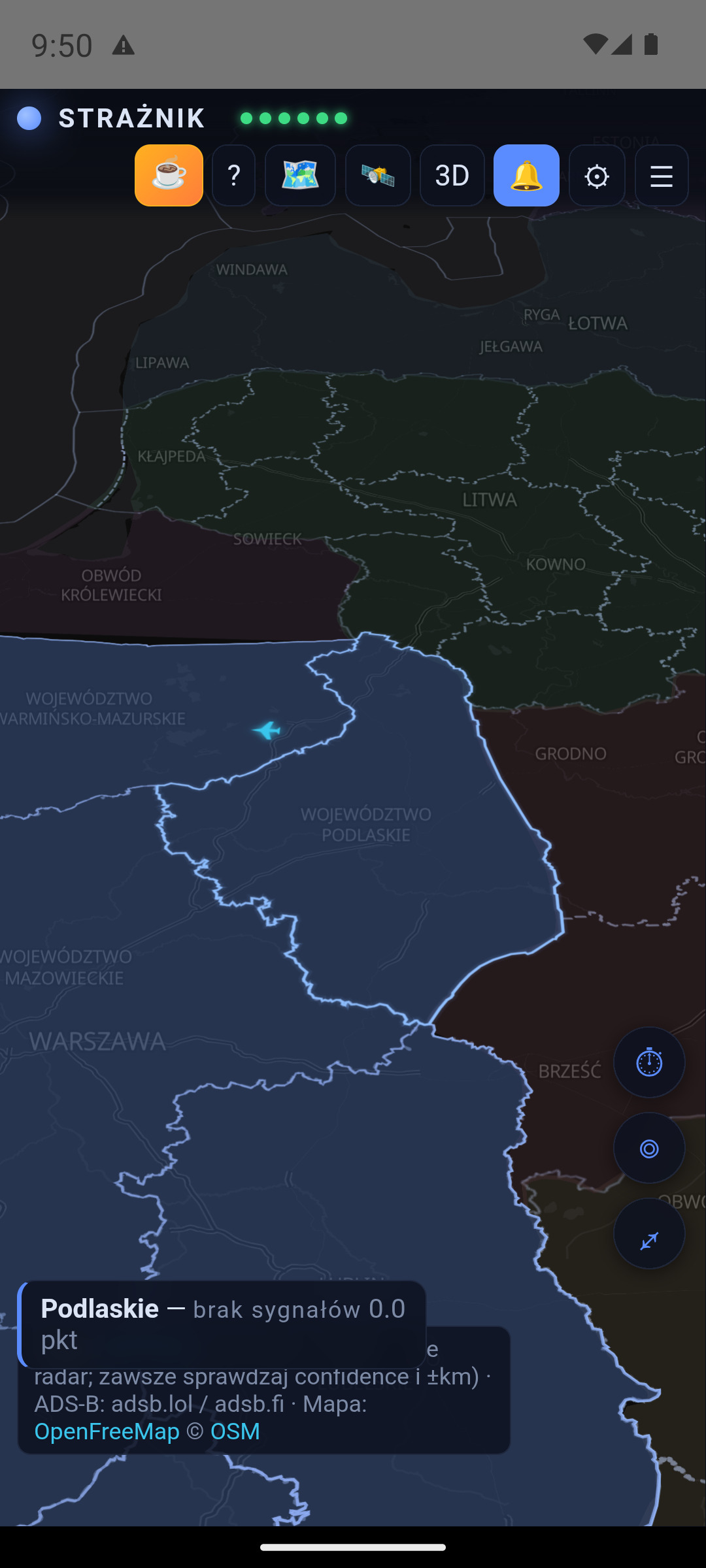
- After every update on Android 14 and later the app shows a one-time “Full-screen alert — check the permission after an update” dialog. Android may turn this permission off when an app from outside the Play Store is updated, and without it a red alert will not wake the locked screen. The “Check permission” button opens the right system toggle. The dialog appears on the next updates, from 1.7.55 onwards.
- Previously the app could miss this: Android can report the permission as granted when it is not, and the warning banner, once closed, never came back. After an update the banner shows again.
- When a network (e.g. a corporate one) drops the live connection right after it opens, the app and the website no longer reconnect every second. After three short connections they fetch the state every few seconds and retry the live connection about every 5 minutes. The map keeps refreshing and the server is not flooded.
1.7.54 — Safer updates and a new licence
Release 1.7.54 · 17 September 2026 · Full release notes
- In-app updates download the file only from Strażnik releases on GitHub and, before installing, check not only the checksum but also that the file is Strażnik signed with the same key as the version on your phone. A forged file is rejected before the Android installer opens.
- From this version the code is under an “all rights reserved” licence; versions up to 1.7.53 stay under MIT. You can still download and use the app for free. The About dialog links to the licence and to third-party licences (NOTICE).
- Alert notifications quote an article title only from known newsrooms and from feeds configured directly; other reports are shown as “Media report” and the full title is visible in the app. An outside site can no longer put its own text into an alert.
- Security fixes after an audit: content from external sources in the signals panel and aircraft card is escaped more strictly, and the server rejects oversized requests and floods of notification sign-ups.
1.7.53 — Drones move again, alert colours no longer flicker
Release 1.7.53 · 16 September 2026 · Full release notes
- Why icons stood still: up to 1.7.47 the app moved a drone ahead of its reports — at a speed typical for its kind and along a presumed heading when NEPTUN gave none. The 1.7.48 audit showed that the icon then flew to where no drone was, sometimes a dozen kilometres further or the wrong way, so we turned it off. Side effect: a drone without a measured speed stood still until the next report and then jumped.
- What now: after each new NEPTUN report the icon glides smoothly from the old position to the new one over 45 seconds, and the track line ends at the icon.
- How this differs from the old movement: the icon only travels along the segment between two real positions — it never gets ahead of the source and never guesses the further flight. While gliding it is up to 45 s behind the report, and afterwards it sits exactly at the reported position. Jumps over 80 km and reports received after returning to the app are shown at once. Objects with a measured speed and heading move as before (up to 18 km, up to 7 min). Points and alerts are still computed from reports, not from the icon position.
- A province colour (yellow, red) is held for 10 minutes after the score last reached its threshold. On 16.09 podkarpackie changed colour 7 times in half an hour — now it would be 2 changes. Raising the level is immediate, and an RCB alert cancellation drops it at once.
- History shows the time offset as “−5 h 57 min”, and on short screens the history panel has more room. Articles saying that aircraft have ended operations no longer add points.
1.7.52 — Neighbouring alerts on the map and stricter Baltic media
Release 1.7.52 · 15 September 2026 · Full release notes
- Ukrainian districts with an air-raid alert light up red or yellow, as in NEPTUN. It is a preview only and adds no points. Tap a district to see the level, start time and reason.
- Lithuania, Latvia and Estonia get a red tint when their media report a declared alert that has not yet been lifted.
- Baltic media weigh less: an incident is 0.5 pt instead of 1. Only a report from the last 30 minutes about something happening now counts — no commentary (“Minister: …”), no reports about yesterday and no articles whose event time is over an hour old.
- Morning recaps and opinion pieces after a night RCB alert (“Nocny alert RCB…”, “Alert RCB zamiast ostrzegać…”) no longer add points.
- The legend has a new section, “Alerts in neighbouring countries (no points)”.
1.7.51 — Older phones, large fonts and a MiG-31K notice matching NEPTUN
Release 1.7.51 · 15 September 2026 · Full release notes
- The MiG-31K take-off notice now matches NEPTUN: “monitoring, not an alert” when Ukraine has not declared a nationwide alert. Previously the app always said “alert across Ukraine”.
- On phones with an older browser engine (e.g. a Galaxy S10 without WebView updates) My places and other dialogs scroll again and show the Save and Cancel buttons.
- With a large system font and on small screens the settings tabs are no longer cut off, map buttons no longer overlap the top bar (icons only when needed), and the signals panel starts below the bar.
- Airspace zones and the foreign aircraft log also load on older Android versions. On a browser engine that is too old, a screen explains what to update instead of staying blank.
- In the browser, objects no longer jump between an old and the current position — the server state is no longer taken from the browser cache.
- Settings say plainly when no province has been chosen for alerts yet, instead of “Unsubscribing this phone from provinces…”. The map adapts when the screen size changes during start-up (tablets, split screen).
1.7.50 — “Alerts on this phone” switch with confirmation
Release 1.7.50 · 15 September 2026 · Full release notes
- Turning alerts off is no longer lost when Android closes the app — previously the phone re-subscribed to its province on the next start.
- The “I don't want alerts” box is now an “Alerts on this phone” switch, as in Android settings.
- When switched off, the phone unsubscribes from every province and the status shows how many it is subscribed to, confirmed by Firebase. Even an alert that arrives before the unsubscription is not shown.
- With alerts off, the sound and alert tests no longer pretend an alert would work; they say how to turn alerts on.
1.7.49 — Fewer false media signals
Release 1.7.49 · 14 September 2026 · Full release notes
- Links to other articles in RSS descriptions (“CZYTAJ: …”) are no longer read as the entry's content — a story about a fraudster no longer scores for a “drone attack” in a recommended headline.
- The month “września” (September) is no longer mistaken for the town of Września, so dates no longer assign articles to Greater Poland.
1.7.48 — More accurate border, honest arrival times and emergency mode
Release 1.7.48 · 14 September 2026 · Full release notes
- Object distance is measured to Poland's actual outline, including the coast: an object over Poland shows “over Poland”, and its heading is compared with the whole country, not the nearest border point.
- A presumed NEPTUN heading (“towards X”) no longer triggers the arrival-time alert until the object's movement confirms it; jet drones (Geran-3) are counted at 450 km/h or their measured speed.
- The card shows arrival time as a range that allows for position uncertainty and data age; in the signal list it ages with the signal.
- Markers no longer drift without measured movement, approximate positions get a wider circle, and an object's track no longer breaks when its ID changes.
- History includes transfers from neighbouring provinces, and emergency mode shows a permanent badge that alerts will not arrive while the app is closed without the server.
- About now lists what the system cannot see: ballistic missiles, the Belarusian direction, Kaliningrad and the Baltic.
1.7.47 — Clearer MiG-31K notice and a steady history bar
Release 1.7.47 · 14 September 2026 · Full release notes
- The MiG-31K take-off notice explains what it means: the aircraft carries Kinzhal missiles, so the take-off alone is an alert for all of Ukraine; no source gives its position, and for Poland it is information, not a threat.
- In history the notice is a small badge in the bar header (full text on tap), so the bar and map buttons no longer jump from under your finger while scrubbing.
1.7.46 — Smoother history and MiG-31K take-off as a notice
Release 1.7.46 · 14 September 2026 · Full release notes
- The map history has a snapshot every minute instead of every two, so scrubbing is smoother.
- A MiG-31K take-off announced by NEPTUN for all of Ukraine is a notice above the province bar, not an icon parked in central Ukraine. It is a nationwide alert without an aircraft position and adds no points; an aircraft reported at a specific place is still on the map.
1.7.45 — Clear national borders on the map
Release 1.7.45 · 14 September 2026 · Full release notes
- Neighbouring countries have clearly different colours, so borders show as a continuous colour edge — no gaps on a tilted or zoomed-out map.
- Crimea is shown within Ukraine, and neighbouring countries no longer overlap in strips (e.g. Lithuania and Latvia).
1.7.44 — Opting out of alerts, drone heading and Baltic media fixes
Release 1.7.44 · 14 September 2026 · Full release notes
- The permission warning on the map has a close button, and ⚙ → Alerts lets you turn alerts off on this phone and keep only the map view.
- The drone icon's nose shows the heading measured from movement — the same as the track and heading line; the card notes when NEPTUN reports a different heading.
- Lithuanian, Latvian and Estonian media: an article about alerts (an interview, questions) is no longer an alert, and a strike in Ukraine is no longer a Baltic incident.
1.7.43 — National borders back to their previous look
Release 1.7.43 · 13 September 2026 · Full release notes
- The more visible white national border outlines have been temporarily removed: parts of them disappeared on the tilted map. The map shows borders as the base map draws them, and refined outlines will return in the near future.
- Object and aircraft tracks from 1.7.42 stay unchanged.
1.7.42 — Continuous borders when zoomed out and visible object tracks
Release 1.7.42 · 13 September 2026 · Full release notes
- National borders no longer break up when the map is zoomed out — including between Belarus and Ukraine, around Crimea and along the front line.
- Object and aircraft tracks show right after opening the app: the server sends a short position history.
- The heading line also uses the track reported by NEPTUN; the track line is more visible.
1.7.41 — More reliable alerts, siren volume and object tracks
Release 1.7.41 · 13 September 2026 · Full release notes
- The open app alerts for every watched province, not only the first place; a push received while the app is open is no longer lost.
- The red siren loops until silenced (the button on the alert screen or “Wycisz alarm” in the notification) and raises the “Alarms” volume to at least half. A full-volume option — off by default, only when deliberately switched on.
- The yellow attention sound respects silent mode and Do Not Disturb. A notification delayed by more than 10 minutes arrives silently with a note.
- Alerts arrive after a phone restart before unlocking; province subscriptions are renewed and confirmed at every start.
- Object tracks on the map: separately for drones and missiles and for aircraft — off, flown track, or track and heading.
- Native red and yellow alert tests in settings, a clearer alert (“what to do”, nearest object), more visible national borders and an RCB/RSO indicator.
1.7.40 — End and duration of Ukrainian oblast alerts
Release 1.7.40 · 13 September 2026 · Full release notes
- The end of an alert in a Ukrainian oblast zeroes its points and switches off the oblast highlight at once. Previously a 10-minute alert kept counting for up to an hour.
- A long alert keeps counting: full weight for the first 30 minutes from its real start, then half while it lasts. Previously an alert lasting hours dropped out of the score after an hour.
- The panel shows when the alert ended or “in progress since …, half weight”, and the oblast card shows when the alert started.
- Lithuania, Latvia and Estonia: feeds and the last alert in the Sources window (on the website since 1.7.38, now in the app too).
1.7.39 — Resilience to traffic peaks
Release 1.7.39 · 13 September 2026 · Full release notes
- On 13 September at 04:54 the server was stopped for lack of memory during a traffic peak and came back after 5 seconds. State, history and zones are now prepared in advance and served through Cloudflare, and the server itself turns away excess website traffic before memory runs out.
- After losing the connection, the app reconnects after a random delay so thousands of phones do not return in the same second.
- When the server is overloaded, the app fetches the state every few seconds instead of keeping a live connection, and tries to return after 1–2 minutes.
- Notifications and data collection work independently of website traffic.
1.7.38 — Readable drone heading, pulsing counted objects, UA oblasts and the Baltics
Release 1.7.38 · 13 September 2026 · Full release notes
- The UAV icon has a red nose and a red arrowhead ahead of it. An object without a known heading is no longer turned nose-north — every type then gets a dashed ring and a question mark. Reconnaissance drones are white-grey.
- Objects that currently add points to a province pulse with a red ring.
- A Ukrainian oblast with an air-raid alert that adds points is gently highlighted in pink; a tap shows the points for each province.
- Lithuania, Latvia and Estonia: new feeds (LRT, 15min, LSM, ERR). An alert announced there is a trace in the panel worth 0.12–0.3; the Sources window shows feed status, the last alert and zones.
- The update window shows the full list of changes. The drone card shows the correct heading offset from the direction to the border.
1.7.37 — Media scored after reading the article, no alert margin, new guide
Release 1.7.37 · 13 September 2026 · Full release notes
- The server reads the whole article before awarding points. A report on an earlier event, or an article that cannot be read, stays in the panel with its link but scores 0. Media add 0.5 or 1 point, capped at 1.
- The notification level always matches the current points. Returning to the same level within 60 minutes does not ring unless a new Alert RCB arrives.
- Alerts in more distant Ukrainian oblasts weigh less — the weight falls smoothly with distance.
- Overlapping zones: a tap opens the smallest one and lists the others as buttons on the card. In history, signal times count from the chosen moment.
- Website: the Strażnik icon in the browser tab, and turning notifications off in settings with the path to the browser permission.
- Helicopters have their own map icon with a rotor disc instead of an aeroplane silhouette. In English, drone cards give place and oblast names in English.
- The user guide was rewritten for the current version, with new screenshots in Polish and English.
1.7.36 — Spillover without double counting, RCB cancellations
Release 1.7.36 · 13 September 2026 · Full release notes
- The same event (an article, a Ukrainian oblast alert) assigned to two neighbouring provinces no longer comes back to the neighbour as spillover. Lubelskie and podkarpackie were inflating each other this way.
- Spillover can only trigger a notification with at least 1 point of own signals, and by one step at most. Colour from spillover alone is dimmed on the map and the card gets a dashed border.
- The in-app sound follows the alert level, not the map colour — a province coloured by its neighbours no longer starts the siren.
- A level drops 0.5 points below its threshold, and returning to the same level within 30 minutes does not repeat the notification without a new RCB alert or NEPTUN object.
- An RCB cancellation in RSO (including an edit of the existing entry) clears the alert and the articles that describe it afterwards.
1.7.35 — Closing a zone card no longer closes the signal list
Release 1.7.35 · 12 September 2026 · Full release notes
- Tapping the close cross on a zone card was closing the signal list instead of the card — the card sits outside the panel, so it counted as a tap beside it.
- Collapsing the panel also moved the card out from under the finger, so the actual click missed the cross. Hence both symptoms at once.
- Scoring is unchanged.
1.7.34 — A veto no longer deletes a genuine report
Release 1.7.34 · 12 September 2026 · Full release notes
- The veto “dni po” was matching inside the Polish word for “eastern district” and deleting a genuine report of fighters being scrambled. Keywords must now start at a word boundary.
- Vetoes are split into hard and soft. “Exercise” or “anniversary” cancel everything, because during a siren test the sirens really do sound. “Will last” or “what we know” only downgrade an operational report from 1.5 to 1.0 points — the event is real, the article covers its effects.
- A soft veto only applies when a critical phrase is present; a plain explainer is rejected exactly as before.
- Thresholds and caps are unchanged — media alone still never raise an alert.
1.7.33 — The zone card is readable, and the grace period really works
Release 1.7.33 · 12 September 2026 · Full release notes
- The zone-disappearance grace period described in the 1.7.30 notes had never been implemented. Without it, this morning’s PAŻP daily-plan rollover would have reported thirty zones as fresh activations.
- The zone designator was hiding under the collapse and close buttons — it now wraps in full.
- The card heading gave a contrast of 1.83:1 on the white card, below any legibility threshold. It is now 5.7:1, using the same approach object cards have used for a long time.
- The guide shows the zone layer in screenshots from the app, in Polish and English.
- Scoring is unchanged.
1.7.32 — The update box speaks in full sentences, a zone promises no end
Release 1.7.32 · 12 September 2026 · Full release notes
- The update box was showing three fragments of a single sentence cut in half — release notes are wrapped, and every line counted as a separate bullet. Now it shows whole points, up to eight, and scrolls.
- A PAŻP zone card said “Planned end: 13.09” even for a zone declared until December. That was the end of the daily slot, not of the zone — the row now reads “Reserved until” and says PAŻP publishes its plan day by day.
- The guide now explains in a table which zones score (D, R, NPZ, ADHOC), which do not (TSA, TRA, ATZ, parachuting, gliding, drones) and where that decision came from — a four-day measurement with no points awarded.
- Scoring is unchanged.
1.7.31 — An article lands where the event happened
Release 1.7.31 · 12 September 2026 · Full release notes
- A nationwide military statement was landing in Greater Poland, because the Polish word for “reconnaissance” contains “poznan”. A place name must now start at a word boundary.
- An article saying the threat is over (“alert cancelled”, “air operations concluded”) scores nothing and fades earlier media reports in that province. It does not touch an official RCB alert.
- A newsroom’s name no longer decides the region — “Romania: a drone hit a block of flats” from Radio Szczecin was landing in West Pomerania.
- The place-name dictionary grew from about 200 to 565 entries, 23 to 49 per province: colloquial region names, larger towns, border crossings and airfields.
- On the same feeds: before the change 8 attributions came from the text and 31 from a guess; after it, 17 from the text and none from a guess.
- A bomb hoax at a school and sirens at commemorations no longer score.
1.7.30 — PAŻP zones are visible, and the north stops being blind
Release 1.7.30 · 12 September 2026 · Full release notes
- A new “zones” button on the map shows active airspace zones. Tapping a zone explains in plain language what it is, since when Strażnik has seen it active, when it is due to end and at what altitude.
- Zones add no points and raise no alert — closing airspace is a decision by the military, not an independent measurement of the threat. The card says so explicitly.
- A long-standing zone gets a quiet outline; only a zone switched on while we were watching gets a 3D block — otherwise 31 zones flooded the map and looked like a nationwide alert.
- The north (Pomeranian, West Pomeranian, Warmian-Masurian, Kuyavian-Pomeranian) is scored differently, because NEPTUN covers Ukraine and gives it zero. A PAŻP zone weighs 1 pt there instead of 0.5, and Baltic incidents and Lithuanian or Estonian airspace closures finally reach the coast.
- No single signal still raises the level on its own: zone 1 + ADS-B activity 1 = 2 pts, zone 1 + Baltic incident 1 = 2 pts. Zones repeating within 7 days are routine and score nothing.
- A province fully covered by a large zone can be tapped again; the zone card leads to the province, and the province card lists its zones.
1.7.29 — You can see what arrived and where the score comes from
Release 1.7.29 · 12 September 2026 · Full release notes
- An article naming several provinces now reaches each of them. An RCB alert “for the Lublin and Subcarpathian provinces” used to reach Subcarpathia only, because the matcher took a single, longest keyword.
- A signal from the last five minutes goes to the top of the list with a NEW badge — a new object worth 0.1 pts used to land below hour-old entries. It returns to its place by contribution afterwards.
- The province card spells the total out: “adds up to: 1.2 RCB + 1.0 UA ALERT + 0.9 MEDIA · 2 signals add nothing”.
- A signal whose object left the map says “no longer tracked” instead of quoting a distance from 40 minutes ago.
- Scoring is unchanged apart from attributing an article to the right provinces.
1.7.28 — The object card and the signals agree
Release 1.7.28 · 12 September 2026 · Full release notes
- The object card only gave the heading in degrees; it now carries the verdict — “0 pts — heading 71° away from the direction to Poland” or “heading towards Poland” — the same wording as the signal list.
- A signal froze the distance from the moment it was raised: the panel said “192.5 km” while the same drone sat 130 km from the border on the map. While the object is still tracked, the row now appends “now 130.0 km”.
- Scoring is unchanged. The rule, for the record: full weight up to ±50° off the direction to the border, a linear fall to zero at ±70°, unknown heading ×0.5 and only within 150 km.
1.7.27 — An object on the map has to appear in the list
Release 1.7.27 · 12 September 2026 · Full release notes
- A drone near the border was visible on the map but missing from “Signals” entirely — because it was flying sideways and scored nothing. The zero was correct, but it looked like the app had missed it.
- The “Signals” section now ends with an “On the map, but scoring 0 pts” list that states the reason — e.g. “heading 86° away from the direction to Poland” or “heading unknown”.
- Scoring is unchanged: an object flying sideways 150 km from the border still contributes zero. What changed is that you can see the app noticed it.
- The “Data sources” dialog now has an English version — it was the last screen whose content stayed in Polish.
1.7.26 — Ukrainian alerts scored by distance
Release 1.7.26 · 12 September 2026 · Full release notes
- Rivne and Zhytomyr oblasts announced themselves as “borders Lublin province” and scored the same as Volyn — while lying 70 and 220 km from the border.
- Points now fall with distance: a shared border ×1.0, up to 120 km ×0.6, up to 220 km ×0.35, up to 320 km ×0.2. Beyond that, nothing.
- Ternopil, Ivano-Frankivsk, Khmelnytskyi, Chernivtsi and Vinnytsia oblasts were added. The same oblast can weigh differently for Lublin and Subcarpathia.
- The title gives the distance instead of an untrue “borders”. The 1.0-point class cap is unchanged — alerts still cannot replace an object on the map.
- Dialogs open from the top and clear the status bar; the legend has bottom padding and a “more below” shadow.
1.7.25 — The update dialog speaks English
Release 1.7.25 · 12 September 2026 · Full release notes
- The whole update path — messages, the “What changes” list, the buttons and the download progress — was hard-coded in Polish and stayed that way in the English interface. It now follows the interface language.
1.7.24 — Fixes after a day on a real device
Release 1.7.24 · 12 September 2026 · Full release notes
- “Check for updates” answers again. GitHub was rejecting the server’s requests with its 60/h per-IP limit; the server now keeps the last known release and serves it instead of an error.
- “Save on device” with an empty name is no longer a dead button — the message scrolls into view and the cursor lands in the missing field. A successful save closes the dialog and returns to Settings.
- The map always opens on the same frame: Poland and the whole of Ukraine. The “my region” button also shows the province in context rather than just its outline.
- The history bar stays put — it used to jump upwards from under your thumb when a signal appeared in the window.
- A new changelog page, reachable from the app: Settings → App → “Changelog ↗”.
1.7.23 — Navigation that stops covering the map
Release 1.7.23 · 12 September 2026 · Full release notes
- Bottom tabs Map · Signals · History · More — labelled and within thumb reach. The top bar now holds only the legend, 2D/3D, foreign aviation, notifications and settings.
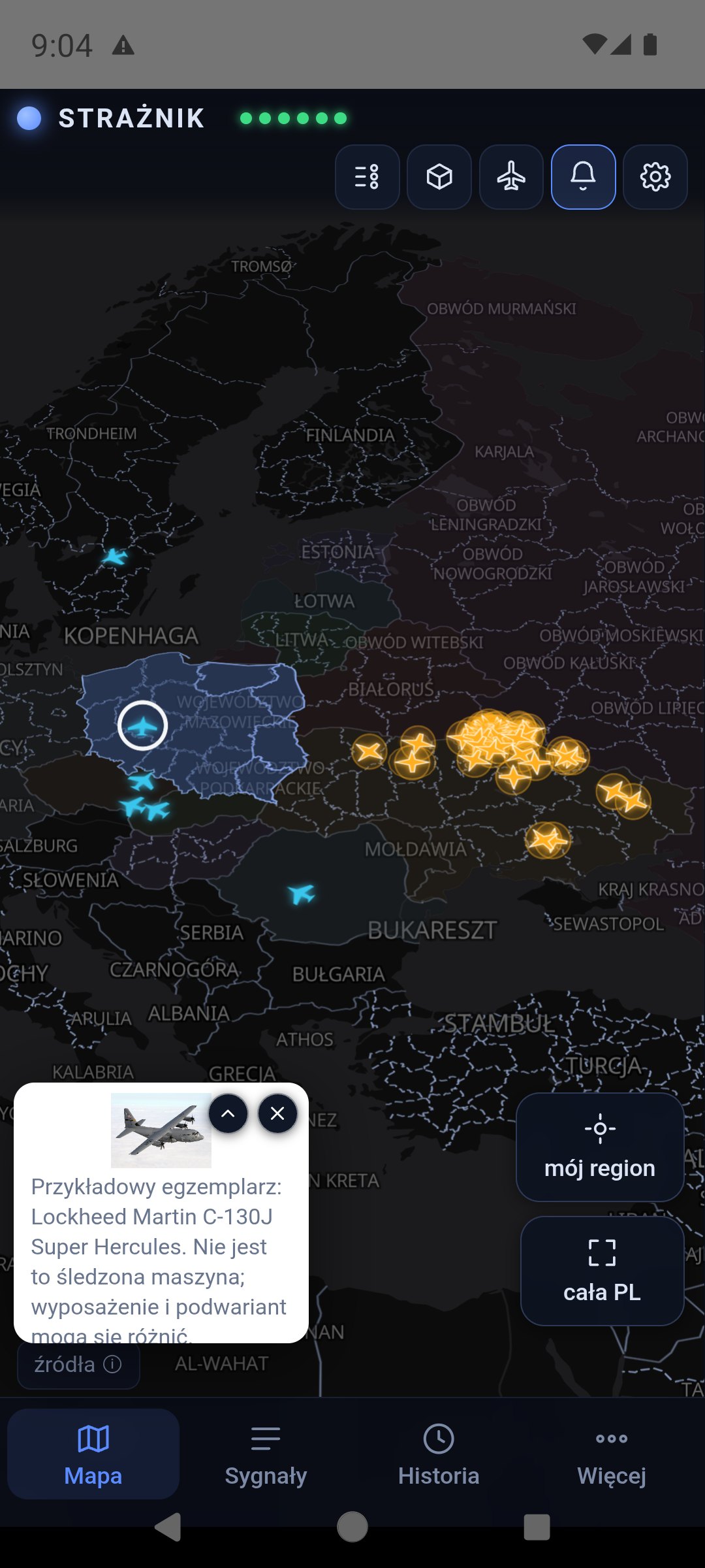
- The object card opens as a thumbnail in the corner instead of covering the map; a chevron expands it to the full card. The selected object gets a white ring on the map.
- Dialogs (“About”, settings, “My places”) end above the tab bar and never reach the Android buttons.
- History mode names itself outright and the slider is considerably larger. Settings split into four tabs.
- Updates are checked at every launch instead of once a day.
1.7.22 — The alert has to be raised — and arrive
Release 1.7.22 · 12 September 2026 · Full release notes
- The source-class cap is assigned after age decay: during a longer attack a fresh object near the border no longer contributes zero.
- The threat level is recomputed every 45 seconds even without a new signal, and survives a server restart.
- Push messages carry a 15-minute expiry and three delivery attempts — a phone coming back online will not get a siren about an event from hours ago.
- Air alerts from western Ukrainian oblasts are finally read (they arrive as raions).
- Points spilled over from a neighbour no longer wake the phone — a notification needs the province’s own signal.
1.7.21 — More careful sources
Release 1.7.21 · 11 September 2026 · Full release notes
- A routine RSS article contributes 1 point, an unambiguous operational response 1.5, and the whole RSS class is capped at 1.5 — media alone can no longer raise the yellow level.
- Historical, anniversary, explainer and legal material stays visible but does not raise the threat level.
- The Lutsk centre point used in NEPTUN reports is recognised as an area position despite the source saying
confirmed.
1.7.20 — Honest approximate positions
Release 1.7.20 · 10 September 2026 · Full release notes
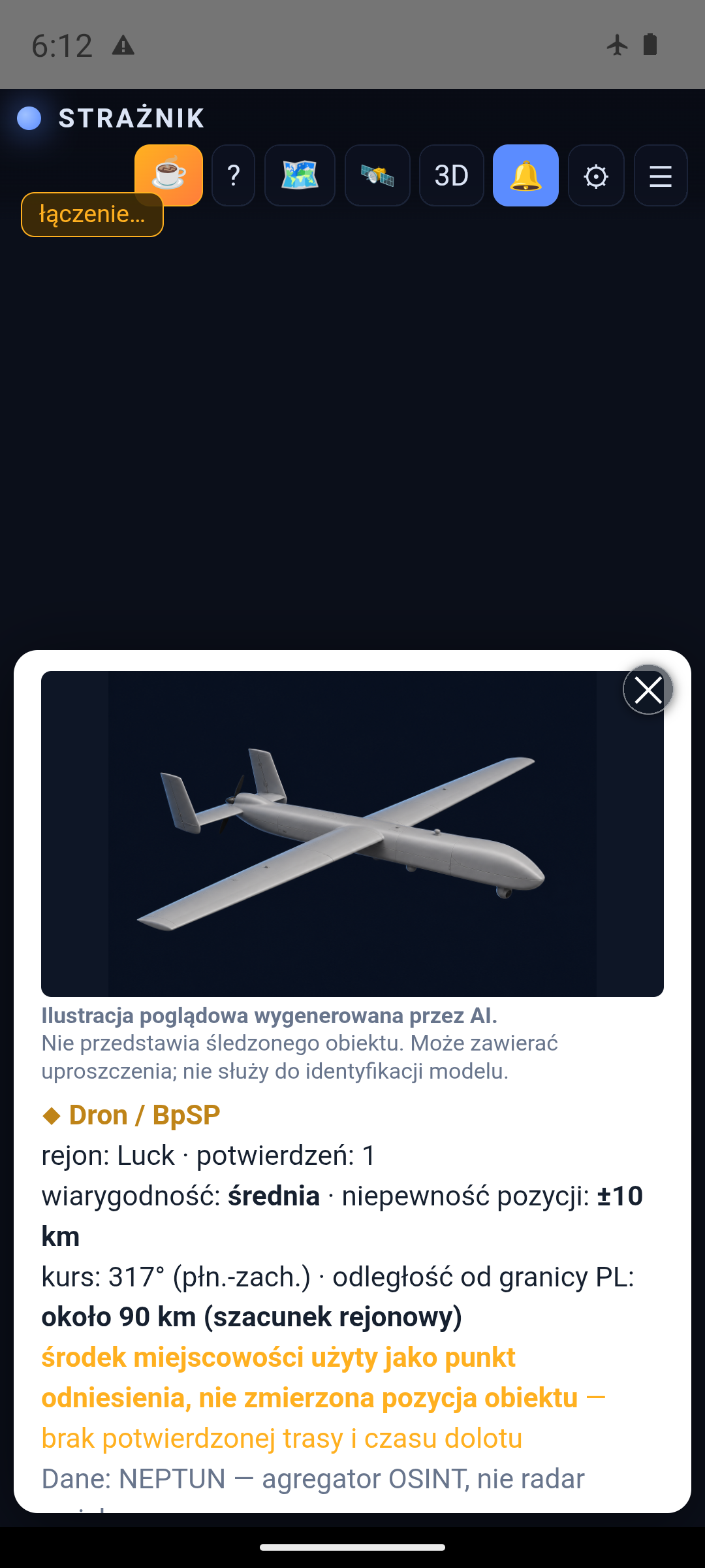
- A point flagged approximate by NEPTUN is described as a report area, not a confirmed object position.
- For such a point the app does not move the marker artificially, does not draw an apparent route and gives no arrival time.
- An approximate position cannot trigger a threshold ETA alert.
1.7.19 — My places
Release 1.7.19 · 9 September 2026 · Full release notes
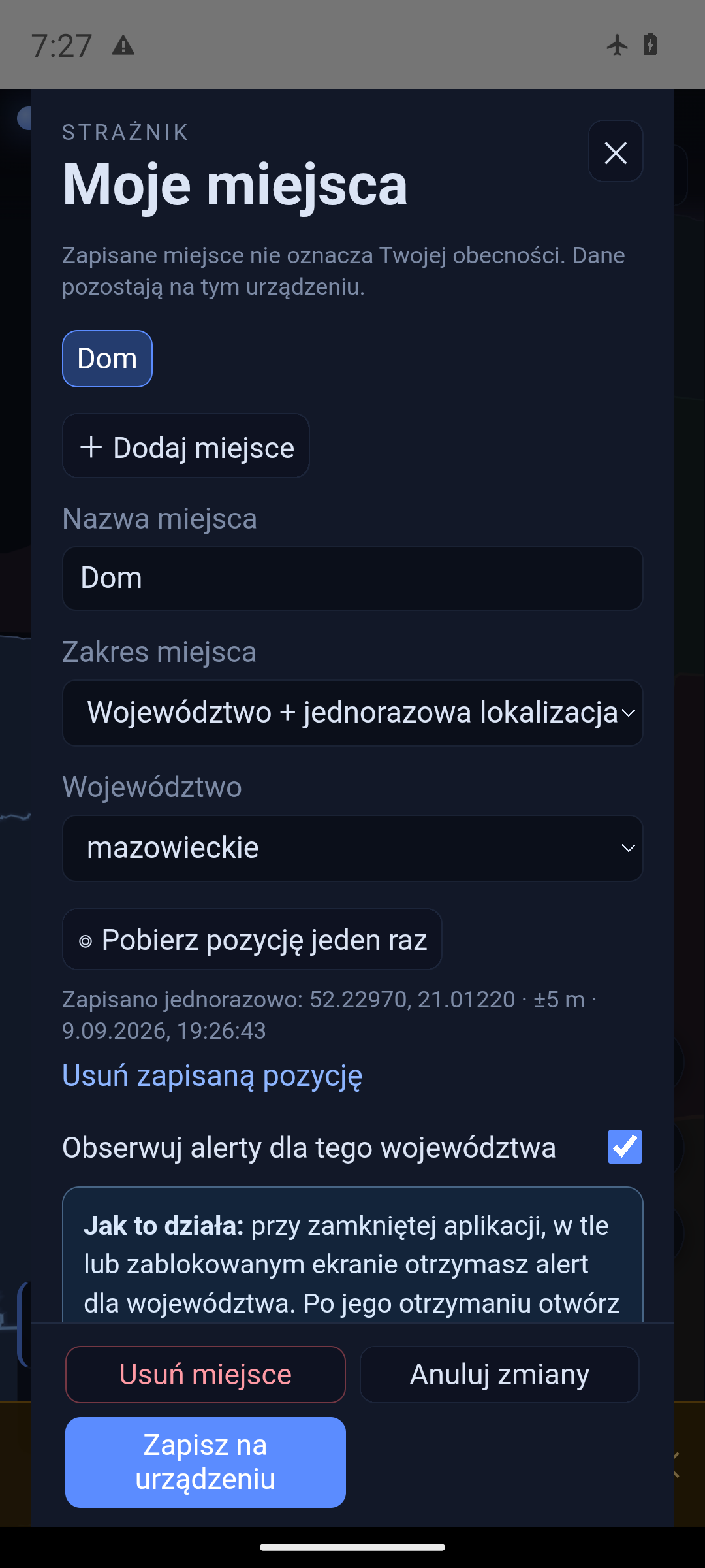
- Up to 8 place profiles stored locally; the old single-province setting is migrated into a “Home” profile.
- Each place can watch its province’s alerts; repeated provinces create a single subscription.
- Optional GPS is read only on request. Place names and coordinates never reach the server or notifications.
1.7.18 — Verified model photographs
Release 1.7.18 · 8 September 2026 · Full release notes
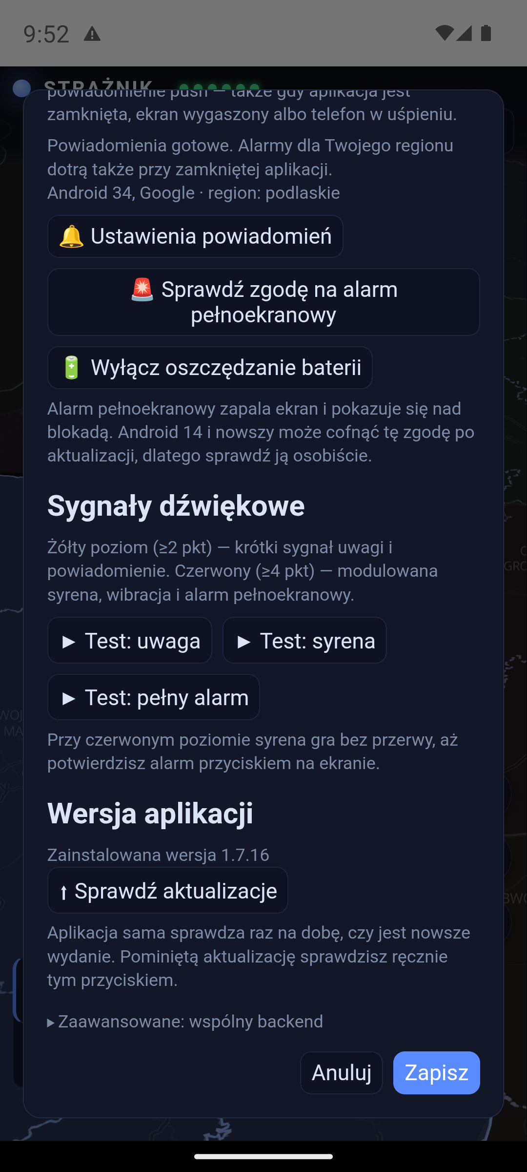
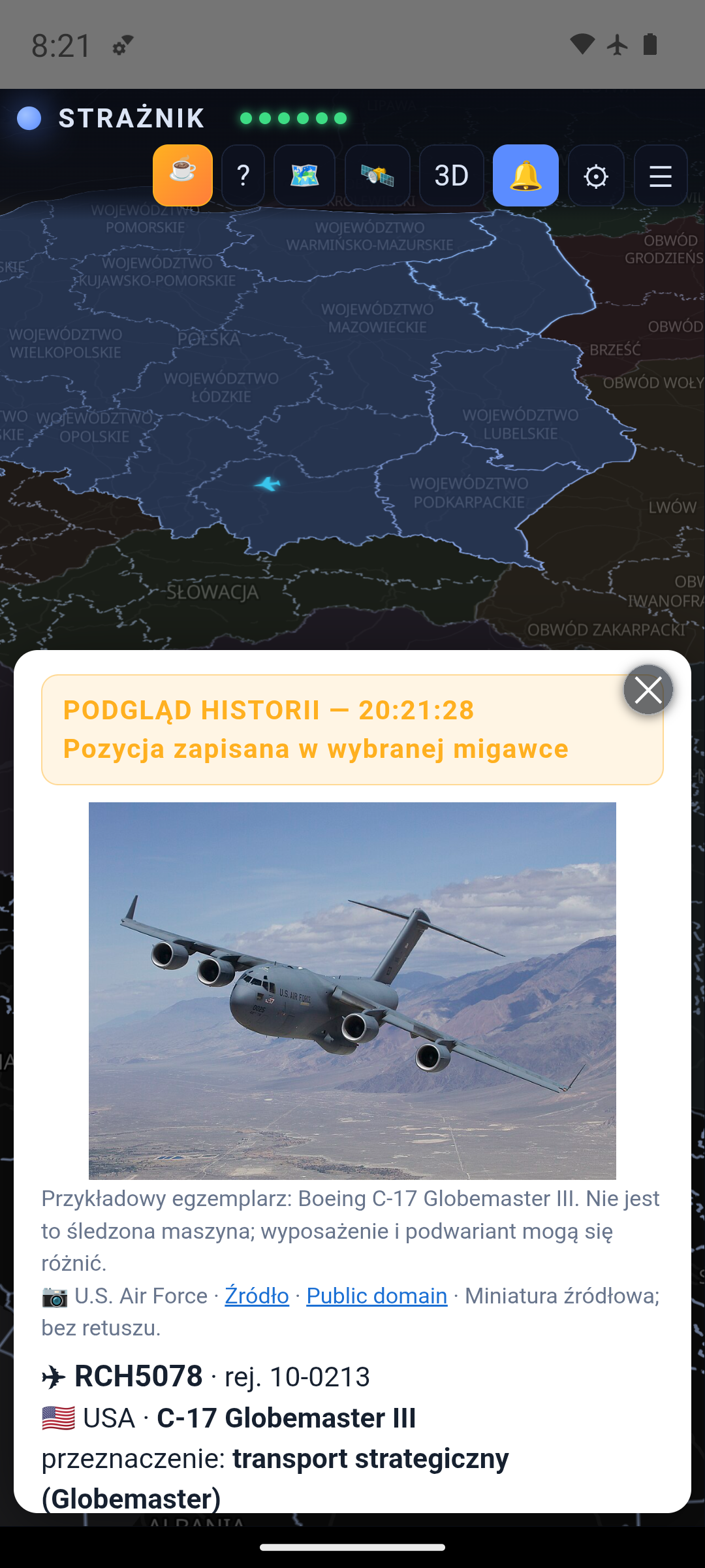
- A local library of 60 verified aircraft and helicopter photographs instead of a random picture from the web.
- Every photograph carries its author, source and licence; none depicts the specific tracked airframe.
- For an unknown or contradictory variant the card says outright that no verified photo is available.
1.7.17 — Consistent time in history
Release 1.7.17 · 7 September 2026 · Full release notes
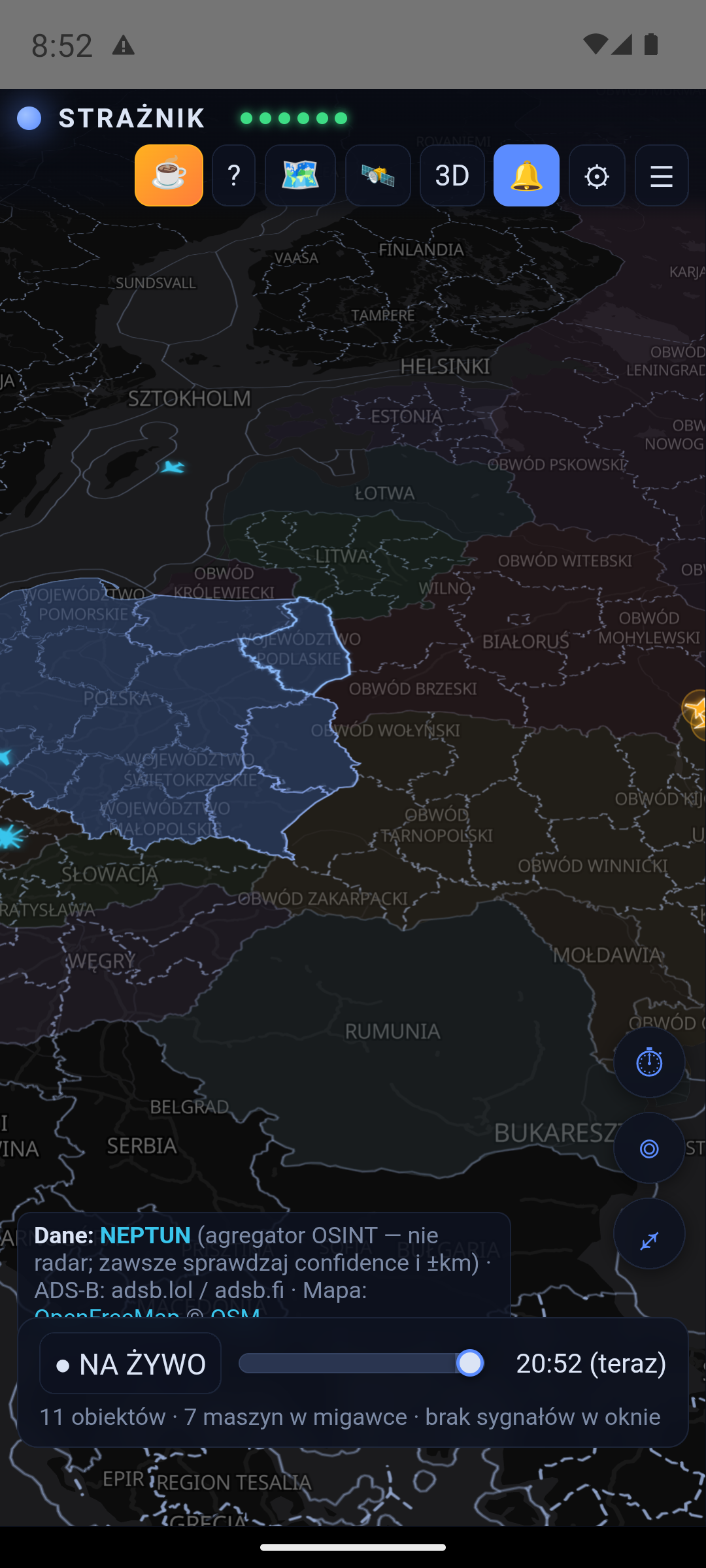
- The map, aircraft list and aircraft details all show the same selected moment — an entry from the future cannot appear in an earlier snapshot.
- Dimmed last positions carry a timestamp and their own counter; they do not mean a landing or a shoot-down.
- The server journal also covers the time while the app was closed.
1.7.16 — English finished off
Release 1.7.16 · 6 September 2026 · Full release notes
- English descriptions for military aircraft: role, country of registration, telemetry and route following.
- The foreign-aircraft view and the missing legend explanations are translated.
- Country, city and region names on the map appear in English; missing names keep the safe source name.
1.7.15 — English interface
Release 1.7.15 · 5 September 2026 · Full release notes
- An English interface for the site and the app, with no change to sources, scoring or technical names.
- Picking a language previews the translated settings immediately; only “Save” makes it permanent.
- The red siren is louder so it is not quieter than the yellow attention signal.
1.7.14 — The update prompt says what it is about
Release 1.7.14 · 4 September 2026 · Full release notes
- The update prompt shows a “What changes” list — up to three key points.
- A non-critical update can still be postponed to the next session.
1.7.13 — Fuller history of foreign aircraft
Release 1.7.13 · 3 September 2026 · Full release notes
- History records entries and exits of Russian and Belarusian ADS-B aircraft together with their last position.
- A short-lived aircraft caught between snapshots no longer disappears from the historical map.
- A position reconstructed from an event is semi-transparent so it does not pose as a regular snapshot.
1.7.12 — Safer connections
Release 1.7.12 · 2 September 2026 · Full release notes
- External servers must use HTTPS; the app trusts only system certificate authorities.
- A custom HTTP address is not saved — an incorrect address stored earlier has to be corrected in settings.
- User settings are preserved across updates.